 Help page for Insignia web
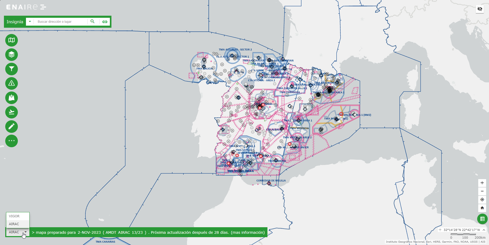
The aeronautical information presented on Insignia comes from the Spanish AIP by ENAIRE in force (INSIGNIA VIGOR) or from the latest AIRAC publication (INSIGNIA AIRAC) dependent on the user-selected configuration.
The AIP is regularly updated every 28 days following the AIRAC cycle. The dates when the data and maps are updated are published on AIP section AIP -> GEN -> GEN 3 -> GEN 3.1 bullet 4 "REGULATED AIRAC PUBLICATION SYSTEM"
The information available in Insignia corresponds to the amendment which name is displayed on the lower left corner of the window. By default the amendment in force.
To display the information from the latest published AIRAC, still not into force, the option AIRAC has to be selected on the drop down menu. When AIRAC information is being displayed, the insignia user interface changes to green color.
NOTAM information can also be displayed. This is dynamic information and can change at any time. The complete NOTAM information can be found at ICARO system
Insignia is a graphical and interactive map representation of the Aeronautical Information available in AIS database.
To access the system it is necessary to accept the legal notice, the privacy policy and personal data protection and the Cookie Policy at the welcome window.
The main viewer screen contains, in the upper left, a SEARCH box:
![]()
This box allows the users to search for locations or entities on the map, based on names, addresses and coordinates. Search by coordinates can be carried out using the following notations:
On the left side of the viewer screen there is a toolbar with several tools accessible by icons:
On the lower part of the window there are available buttons to act on: the map zoom level, to go to current GPS location, to go to the initial map extent, to display certain feature types in a tabular format, the mouse coordinate and the scale:
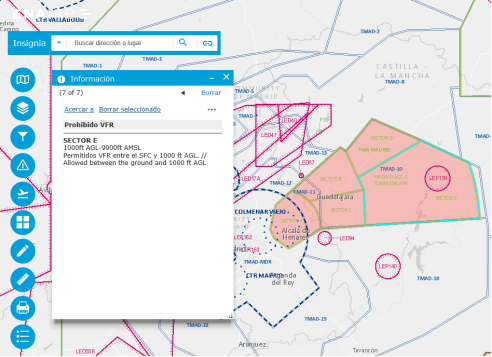
By clicking on any point in the map a pop up window is displayed with information on the identified features.
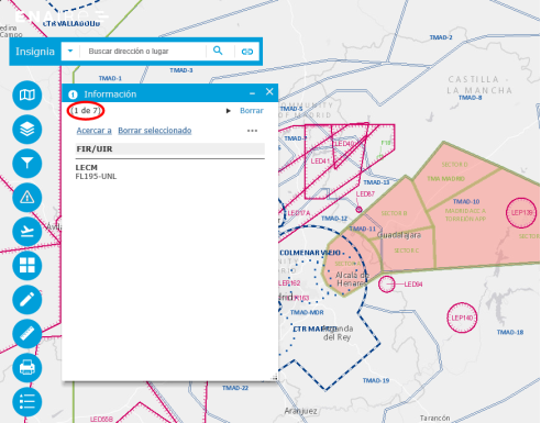
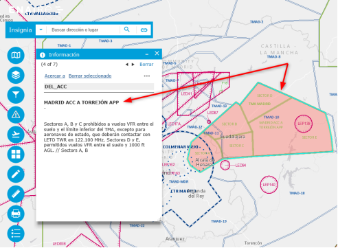
Cycling over the list of the selected features is possible by using the arrows at the upper left corner of the pop up window.
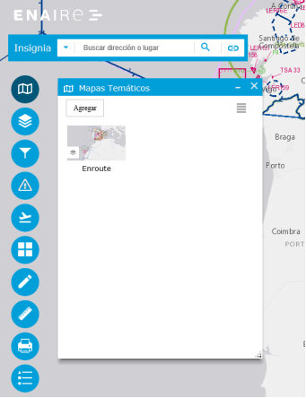
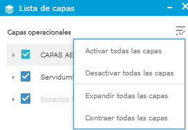
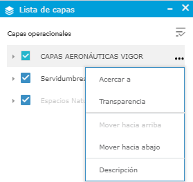
Initially, the only pre-configured thematic map is the AIP Enroute chart, additional ones can be saved by each user after configuration using the Layer List tool.
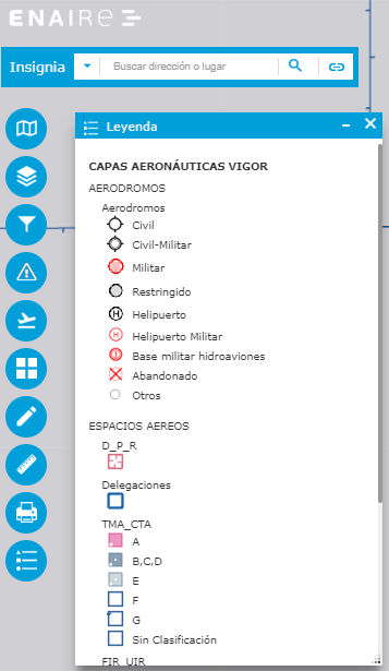
Using this tool the feature types to be displayed on the map can be set. The following feature types are available:
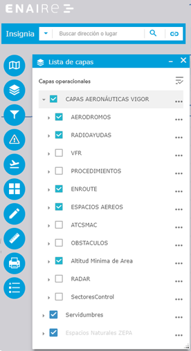
Using a tree like navigation, layers can be expanded to reveal more elements.
A description about the layer can be accessed. Transparency can also be set for certain layers.
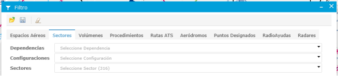
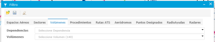
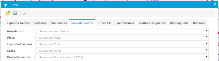
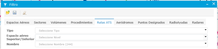
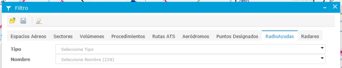
Use this tool to restrict the elements to be shown on the map for a selected set of aeronautical features types. By applying a filter, the related feature types on the Feature List tool are automatically turned on.
There are filters available for the following feature types:
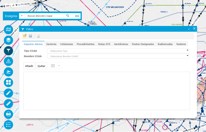
For each feature type a different set of parameters to specify the filters is available:


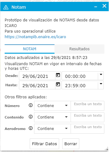
This tool allows access to the NOTAM visualization prototype at Insignia. For operational use or PIB generation please go to ICARO.
NOTAM related to the following circunstances are depicted with rich geometry:
All other NOTAM are depicted as points.
A date/time range is mandatory and optionally filtering can be done by number (series, number and year concatenated) and/or content (field E) and/or aerodrome (field A). Partial matched being accepted, for example filtering by:
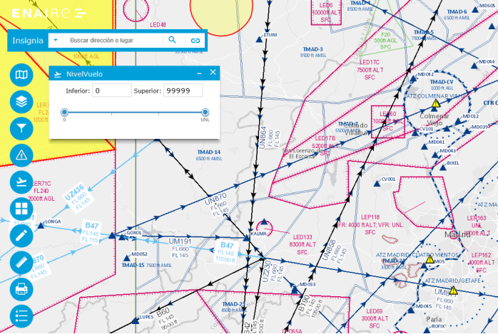
Using this tools a range of flight levels can be selected, the map will adjust to display only features within that range. It only applies to features with elevation information available; like for example air spaces.
Example of display without filters
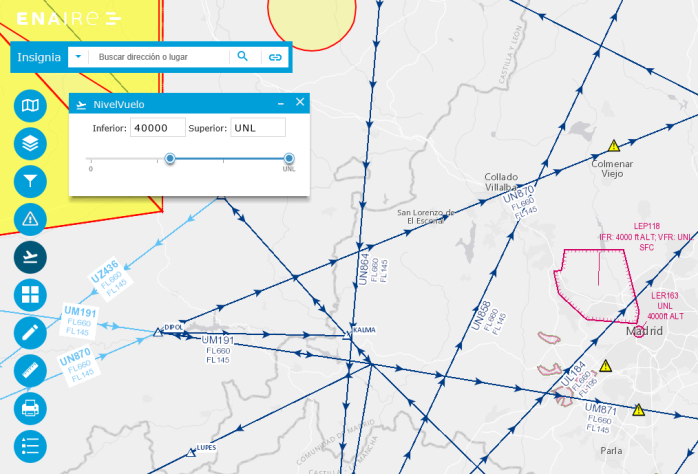
Example of FL400 to unlimited filter range.
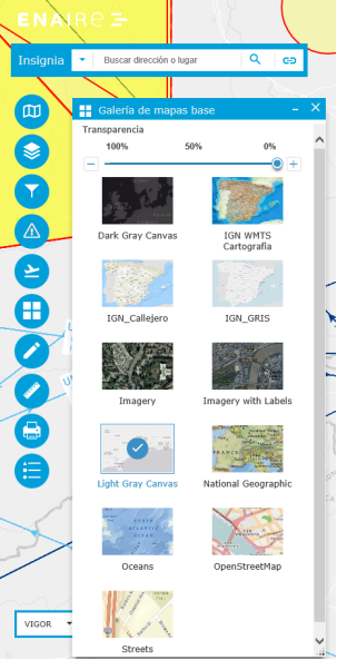
The tools displays a gallery of available base maps, from which to select the one to be displayed. The maps come from sources external to ENAIRE.
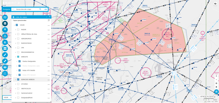
Example of "Light Gray Canvas" base map with "ENROUTE" and "ESPACIOS AÉREOS" aeronautical layers.
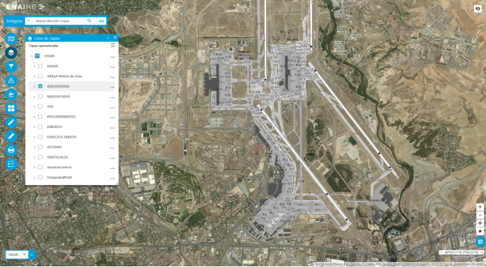
Example of "Imagery" base map and "AERÓDROMOS" aeronautical layer.
The tool has several options to draw element on the map.
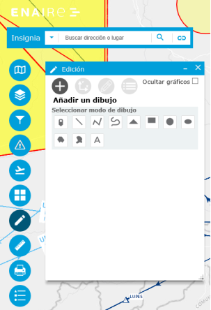
Freehand draw options.


There are available tools to draw geometries based on coordinates. Hints are available at certain places.
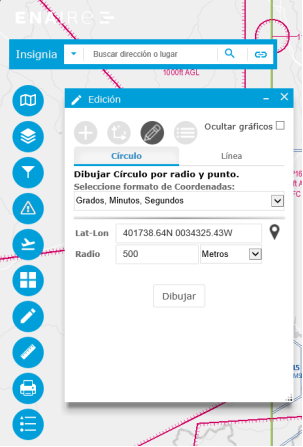
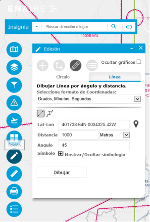
Tools to draw circles and lines based on several parameters are available.
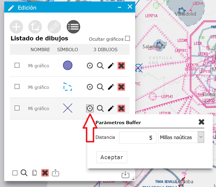
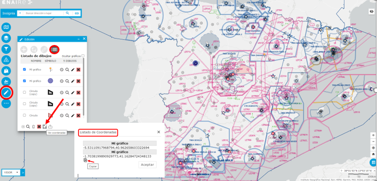
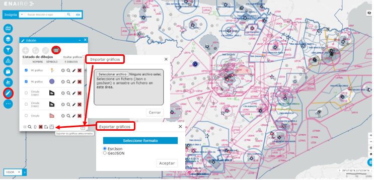
There is also the option to access a list of the elements drawn, zoom to them, edit and delete. At the bottom there are also options to act on all drawing at the same time, including exporting and importing drawings.
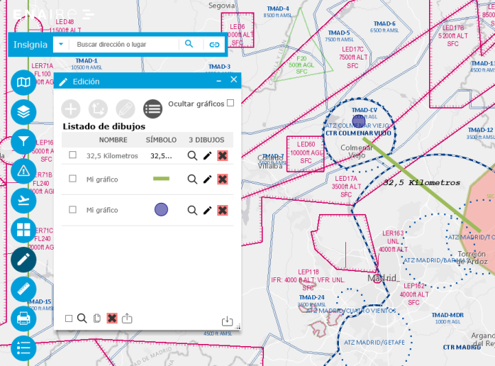
From this list of elements a new one can be created as buffer on an existing one
Display coordinates list of selected graphics. They can be displayed in decimal degrees (DD), degrees minutes and seconds (DMS) notation and AIP format.
Import and export of graphics in JSON and GeoJSON formats:
Used to calculate the area or distance of a defined element. Output measurement units can be defined.
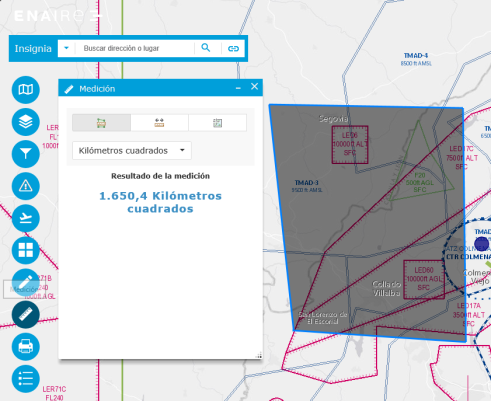
Area measurement example.
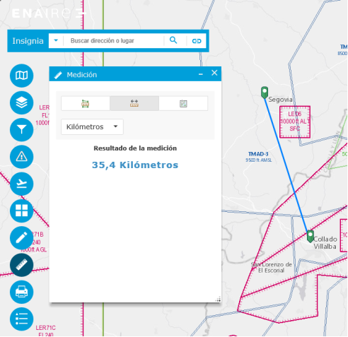
Line measurement example.
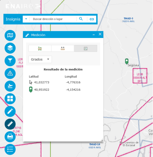
Coordinates readout example. Both of the clicked map point and the current mouse position.
The previous measurement can be deleted by selecting any other of the measurement options at the top of the window.
Several options are available to obtain a printout of the currently displayed map in JPG and PDF formats.
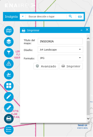
Quick print.
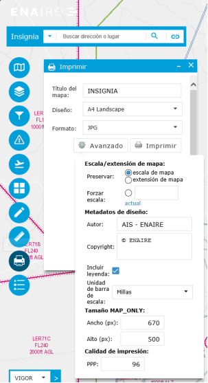
Advanced print.